Professional Land Surveyors of Colorado


September 2024
SunMonTueWedThuFriSat
1 2 3 4 5 6 7
8 9 10 11 12 13 14
15 16 17 18 19 20 21
22 23 24 25 26 27 28
29 30
Events available for Registration...

2025 PLSC Membership
1/1/2025 - 12/31/2025
register for this event...

2025 Side Shots Advertising
1/1/2025 - 12/31/2025
register for this event...

RMSS 2025 Virtual Classes
4/1/2025 - 4/3/2025
register for this event...

Events in the month of September 2024
9/13/2024
Summer Seminar – Friday, September 13, 2024
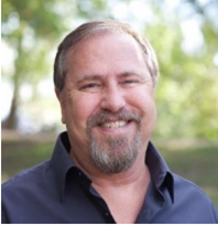
Seven Pillars of Surveying: For and Against
A Presentation by
John Stahl
Offered Remotely
and In-Person at Arapahoe Community College,
 Room 3160 Main Building
5900 S. Santa Fe Drive
Littleton, CO 80120
8:30am to 3:30pm
$50 for Students, $100 for Members, $150 for non-Members
 
Registration is open!

John B. Stahl, PLS, CFedS, is a licensed professional land surveyor in the states of Utah and Montana, currently owning and operating Cornerstone Professional Land Surveys, Inc., and Cornerstone Land Consulting, Inc., in Salt Lake City. Mr. Stahl specializes in surveying land boundaries, resolving boundary conflicts, performing title and historical research, land boundary consultation services, mediation, and dispute resolution. He has been qualified as an expert witness in numerous boundary, access, and negligence cases and has actively participated in the preparation of amicus curiae briefs to the Utah Supreme Court.
9/27/2024
Dealing with Completion and Extension Surveys in the PLSS (Morning)
Where the Manual is Silent (Afternoon)
Friday, September 27, 2024


Agenda:
Morning Session (8AM-12:00PM): This class shows the importance of the record and lotting on the plats to determine where one might have double corners, bearing breaks, and other phenomena reserved for the township not surveyed all at the same time. This course features real examples from most western states.
Lunch (12:00PM-1:00PM)
Afternoon Session (1:00PM-5:00PM): A half-day course that expands on a number of topics never addressed by GLO or BLM in retracement issues in the PLSS. This course goes into the details of what we need to consider to still be within the scope of the law, as well as what we need to document to show our peers why we did what we did. Examples: Lost corners in section subs, multiple WCs at a section corner, and why the Grant Boundary Method will not work for many non-rectangular entities.
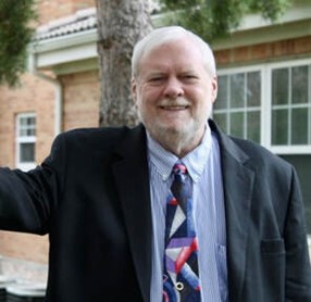
A Presentation by Dennis Mouland, PLS

$50 for Students, $100 for Members, $150 for non-Members
$20 Lunch from Waltzing Kangaroo* featuring gourmet Aussie meat pies, whirled peas and mashed potatoes. Includes drinks and dessert.
 
Dennis is a professional surveyor in Arizona and Colorado.  He recently retired his licenses in New Mexico and California. He has a Bachelor of Arts degree in Organizational Management and has been in the surveying profession since 1972 (52 years).  His experience is evenly split between the private sector, including his own surveying firm, and federal government employment.


Dennis has been an instructor and course manager for the BLM/Forest Service “Advanced Cadastral School” and served as the National Cadastral Training Coordinator for BLM in Phoenix, AZ for over 6 years.  In that position he developed the Certified Federal Surveyors Program for the Department of the Interior.  In addition to having over 100 technical articles published in the U.S. and Canada, Dennis is a contributing author to the textbook “The Surveying Handbook” and authored “Ethics for the Professional Surveyor” in 1996, with a second edition published in 2021. He is also the author of the textbook “Public Lands Retracements in the 21st Century” in 2020.  He has conducted seminars for the surveying and real estate professions since 1984 which have included over 225,000 students to date. 

PLSC (Colorado) awarded Dennis with a lifetime membership in 1998 and APLS (Arizona) gave him a lifetime achievement award in 2005. Also in 2005, he was named one of the top 25 surveyors in the country in the previous 25 years by Professional Surveyor magazine.

Dennis has taught boundary law subjects in higher education institutions since 1995 including at the University of Wyoming, Metro State University of Denver and Oklahoma State University.  He lives near Denver, Colorado.
 
9/4/2024
We will be kicking off our 2024-2025 season with a planning meeting next week Wednesday, September 4, at the new Tait office in Loveland from 6-8PM and will be providing chips and sandwiches (no fee required).
 
Please come with ideas for the new season ahead. We will be discussing meeting topics, other activities and upcoming elections for the Northern Chapter. Please come with ideas! We look forward to seeing you soon.
9/10/2024


Panel Session on Preparing for NSRS Modernization at GeoGov 2024


You are invited to listen in to a panel discussion between NGS and other federal and industry leaders at the GeoGov 2024 Summit on September 10th at 11am EST on the challenges, benefits, opportunities, and rollout of the modernized National Spatial Reference System (NSRS). The panel will be moderated by Brad Kearse, Deputy Director of NGS. Rachael Dempsey, Deputy Assistant Administrator for NOAA’s National Ocean Service will provide opening remarks. Panel members will include:
  • Dan Roman - Senior Advisor For Geodesy at NGS
  • Dana Caccamise - NGS Pacific Southwest Regional Geodetic Advisor
  • Tim Burch - Executive Director of National Society of Professional Surveyors
  • Josh Novac - Senior Geospatial Technology Manager with Dewberry
  • Linda Foster - Director, Land Records/Cadastre Solutions at Esri
  • Mike Tischler - Director of the National Geospatial Program (NGP) at the U.S. Geological Survey 
Due to the high level of interest, this session is being made available for remote participation by Geospatial World, however it will not be recorded. The following link is available for those wishing to listen to the panel discussion: 
 
Microsoft Teams
Meeting ID: 435 184 550 245
Passcode: UJzpwW
 
Background: The modernized NSRS is planned to be approved in 2026, at which point all federal agencies will be required to adopt it as the foundational component of their geospatial infrastructure. A beta version of the modernized NSRS is planned to be released in 2025 for testing and feedback by stakeholders.
 
The NSRS is the foundational component of our national spatial data infrastructure. In the next few years, every survey, map, lidar point cloud, aerial image, digital elevation model, and other critical geospatial datasets and products, will have outdated coordinates. For the first time in over 30 years, NOAA’s National Geodetic Survey will release a modernized version of the National Spatial Reference System (NSRS), the authoritative system of latitude, longitude, heights, and the national shoreline that serves as the foundation for all US federal maps and geospatial products. Not only will the modernized system provide billions of dollars worth of benefits through increased accuracy, national consistency, workflow efficiency, and data interoperability, federal law requires that federal agencies comply with this new standard. This change will have far reaching implications for the use of federal funds for surveying, mapping and production of geospatial products. Evaluating and addressing the impacts of these changes for existing data, products, and geospatial workflows will require time and resources, so NOW is the time to begin planning for the transition to the modernized system.


9/18/2024 - 9/21/2024
Plan now to join us for Surveyors Rendezvous 2024! This year's Rendezvous is September 18-21 at the Hotel Julien in Dubuque, IA.
 
In addition to the many social activities, Rendezvous 2024 attendees can earn up to 9.5 PDHs* by participating in these informative education sessions:
  • Finding the Charcoal Mounds – Milton Denny, PLS
  • Beginning of the GLO – Ann Besch, PS
  • The Fifth Principal Meridian: Its Initial Point & Its Errors – Dick Elgin, PhD, PE, PLS
  • Uniquely Iowa: Surveys Between the Rivers – Greg Chlebicki, PLS, PE
  • The South Line of Iowa/North Line of Missouri – Darrell Pratte, PLS
  • The Iowa/Minnesota Border – Don Borcherding, PLS
  • GLO: The Prairie Years - Instructions and Practice – Milton Denny, PLS
  • The History of Dubuque Surveys and Lead Mines – Jeff Brandt, PLS/RLS & Hugh McCarron
  • History of Australian Surveyors until 1824  – John Brock, PLS
  • Letters of the GLO – Rich Leu, PLS
The complete schedule of events can be found here.
 
*Individual licensees are responsible for determining if specific educational sessions are acceptable for license renewals in the jurisdictions where they practice.
 

How to Register

Use the button below to register online using a credit card or click here for the Rendezvous brochure and registration form to register by mail.